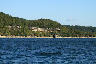
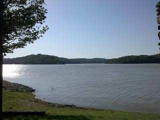
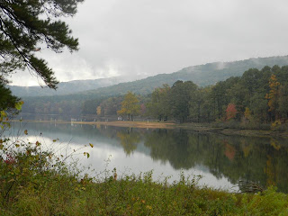
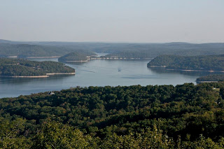
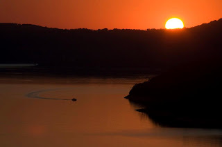
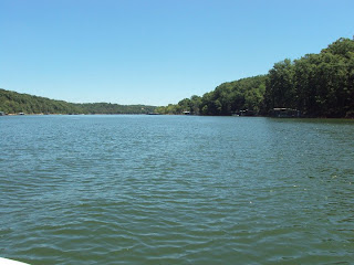
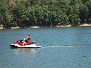
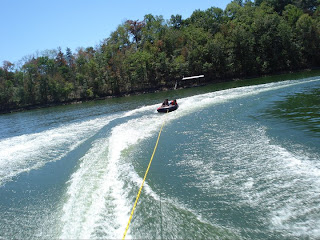
Beaver Lake is a man-made reservoir in the Ozark Mountains of Northwest Arkansas and is formed by a dam across the White River. Beaver Lake has some 487 miles of natural shoreline. With towering limestone bluffs, natural caves, and a wide variety of trees and flowering shrubs, it is a popular tourist destination.The 28,370-acre lake is the first of the impoundments created in Arkansas and Missouri along the lengthy White River system.
Taking advantage of the natural scenic beauty, the U.S. Army Corps of Engineers has constructed a variety of recreational facilities. Paved access roads wind through 12 developed parks. There are 2,008 acres of campgrounds and over 650 individual campsites. Visitors can enjoy such conveniences as electricity and fire-rings. Drinking water, showers and restrooms are nearby. Other facilities include picnic sites, swimming beaches, hiking trails, boat launching ramps, sanitary dump stations, fishing, group picnic shelters and amphitheaters.
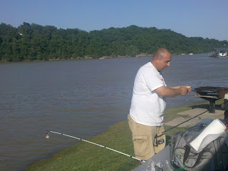
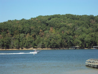
With 487 miles of shoreline highlighted by limestone bluffs, Beaver Lake offers a world of recreational opportunities. Marinas and outfitters are plentiful. Cabins, resorts and other lodging ring the lake, and campgrounds are also available in good number.The lake offers clear-water fishing at its north end and dingy water fishing in the tributaries flowing in from the south. When quick rises in its level move muddy water northward, the lake’s midsection often produces outstanding shallow-water fishing. Some worth checking out include War Eagle Creek, the White River, Ford’s Creek, Cedar Creek and Rambo Creek. The hybrid daily limit is three on Beaver Lake.
Three-fourths of Beaver Lake is in Benton County, the remainder in Carroll County.
Nearby Cities:
- Avoca
- Beaver
- Bella Vista
- Benton
- Bentonville
- Eureka Springs
- Lowell
- Rogers
- War Eagle
Beaver Lake Project Office Contact:
2260 North 2nd Street
Rogers, AR 72756
(479) 636-1210
Campgrounds - Places to See:
Dam Site Lake
Description: Class A park with flush toilets, showers, trailer dump station, designated camping spaces, trash containers, and drinking water. Dam Site Lake’s campsites are non-reservable and are occupied on a first-come first-serve basis. The picnic shelter located at the cut-off wall approximately 1/4 mile from the campground is available for reservation year round.
Location: Dam Site Lake is located 9 miles west of Eureka Springs on U.S. Highway 62, then 3 miles south on paved access road State 187 to dam.
Facilities: 48 campsites with electricity. 1 picnic shelter.
Dam Site River
Description: Class A park with flush toilets, showers, trailer dump station, designated camping spaces, trash containers, and drinking water. All 59 campsites are available for reservation through Recreation.gov.
Location: Dam Site, River is located 9 miles west of Eureka Springs on U.S. Highway 62, then 2.5 miles south on paved access road State 187 to dam.
Facilities: 59 campsites with electricity. Sites 1-12 have 50 amp electric and water to each site.
Hickory Creek
Description: Class A park with flush toilets, showers, trailer dump station, designated camping spaces, trash containers, and drinking water. Several campsites are available for reservation through Recreation.gov. Two picnic shelters and five multi-family shelters are located in the day use area and are available for reservation year round. A multipurpose field for soccer, football, etc. is located in the day use area.
Location: Hickory Creek is located 1 mile north of Springdale on U.S. Highway 71, then 7 miles east on State Highway 264, then 1 mile north on Benton County Road 602.
Facilities: 61 campsites with electricity. 2 picnic shelters.
Horseshoe Bend
Description: Class A park with flush toilets, showers, trailer dump station, designated camping spaces, trash containers, and drinking water. Several campsites are available for reservation through Recreation.gov. Two picnic shelters are located in the day use area and one picnic shelter is located in the campground. Both are available for reservation year round.
Location: Horseshoe Bend is located 5 miles east of Rogers on State Highway 94.
Facilities: 188 campsites with electricity. 2 picnic shelters.
Indian Creek
Description: Class A park with flush toilets, showers, trailer dump station, designated camping spaces, trash containers, and drinking water. Indian Creek’s campsites are non-reservable and are occupied on a first-come first-serve basis.
Location: Indian Creek is located 5 miles east of Gateway, then 4 miles south on Benton County Road 89.
Facilities: 33 campsites with electricity.
Lost Bridge North
 Description: Class A park with flush toilets, showers, trailer dump station, designated camping spaces, trash containers, and drinking water. All 48 campsites are available for reservation through Recreation.gov. There is a primitive youth camping area for use by small groups and is available for reservation year round through the NRRS.
Location: Lost Bridge North is located 6 miles southeast of Garfield on State Highway 127.
Facilities: 48 campsites with electricity.
Lost Bridge South
Description: Class A park with flush toilets, showers, trailer dump station, designated camping spaces, trash containers, and drinking water. Several campsites are available for reservation through Recreation.gov.
Location: Lost Bridge South is located 5 miles southeast of Garfield on State Highway 127.
Facilities: 36 campsites with electricity. 1 picnic shelter.
Prairie Creek
Description: Class A park with flush toilets, showers, trailer dump station, designated camping spaces, trash containers, and drinking water. All 112 campsites are available for reservation through the Recreation.gov. Three picnic shelters and three multi-family shelters are located in the day use area and are available for reservation through Recreation.gov year round. The Prairie Creek Grand Shelter is located in the day use area and is available for reservation through the Beaver Lake Project Office year round.
Location: Prairie Creek is located 4 miles east of Rogers on State Highway 12, then 1 mile on access road.
Facilities: 112 campsites with electricity. 4 picnic shelters and 3 multi-family shelters.
Rocky Branch
Description: Class A park with flush toilets, showers, trailer dump station, designated camping spaces, trash containers, and drinking water. Rocky Branch’s campsites are non-reservable and are occupied on a first-come first-serve basis. Two picnic shelters are available for reservation year round.
Location: Rocky Branch is located 11 miles east of Rogers on State Highway 12, then 4.5 miles northeast on State Highway 303.
Facilities: 44 campsites with electricity. 2 picnic shelters.
Starkey
Description: Class A park with flush toilets, trailer dump station, designated camping spaces, trash containers, and drinking water. Starkey’s campsites are non-reservable and are occupied on a first-come first-serve basis. The picnic shelter is available for reservation year round.
Location: Starkey is located 4 miles west of Eureka Springs on U.S. Highway 62, then 4 miles southwest on State Highway 187, then 4 miles southwest on Carroll County Road 2176.
Facilities: 23 campsites with electricity. 1 picnic shelter.
War Eagle
 Description: Class A park with flush toilets, showers, trailer dump station, designated camping spaces, trash containers, and drinking water. War Eagle’s campsites are non-reservable and are occupied on a first-come first-serve basis. The picnic shelter is located near the campground and is available for reservation year round.
Location: War Eagle is located 10 miles east of Springdale on State Highway 412, then 3 miles north on Washington County Road 95.
Facilities: 26 campsites with electricity. 1 picnic shelter.


No comments:
Post a Comment